
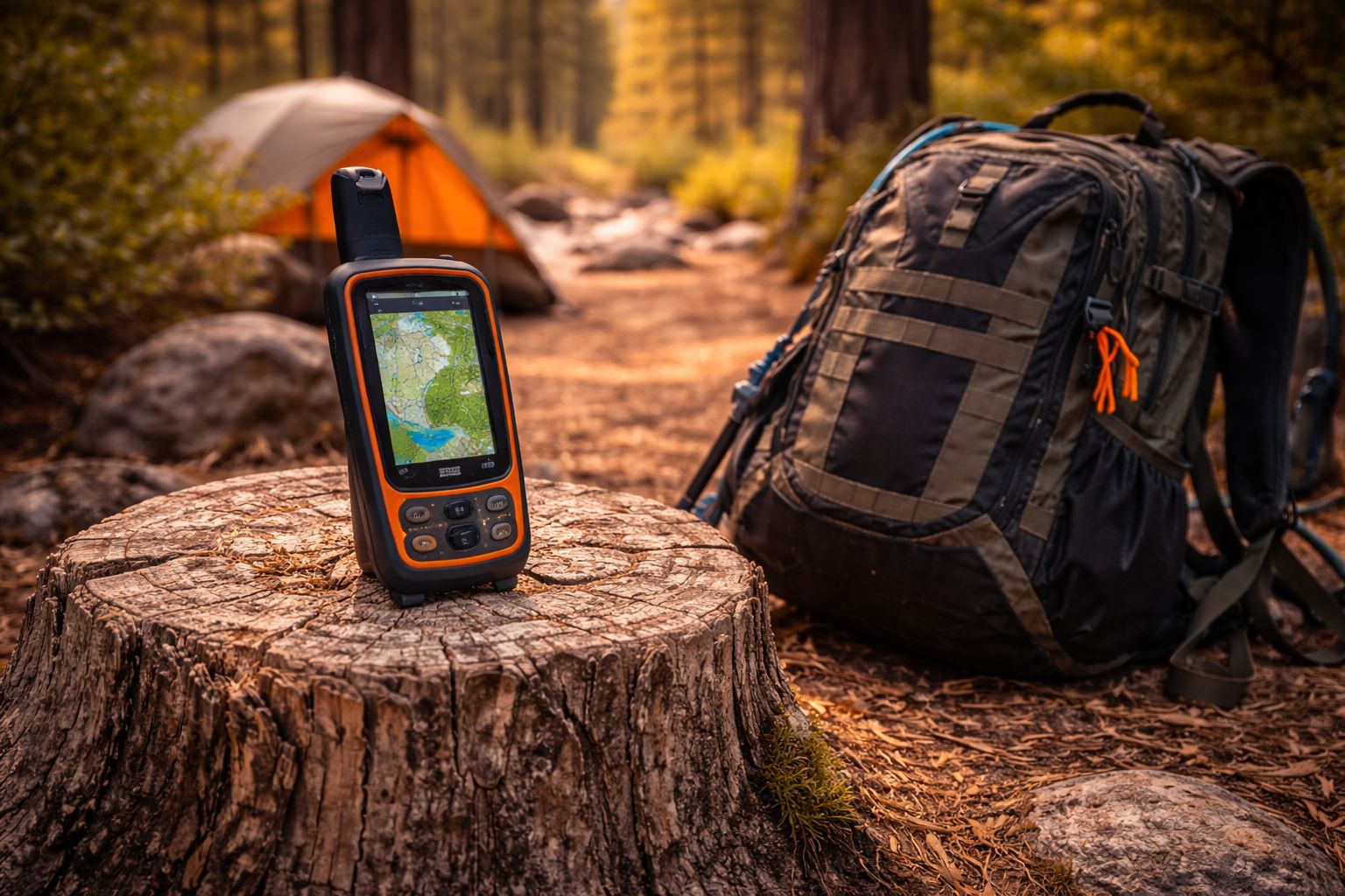
5 Best Hiking GPS Devices: Your Ultimate Trail Companion
When you’re choosing the right hiking GPS device, you want reliability, long battery life, and accurate maps in rugged conditions. This guide compares top devices, from compact backups to feature-packed models with satellite messaging. Each option has its strengths, so you’ll see how to match you—your routes, terrain, and gear—to the trail ahead. And as you weigh hands-on practicality against price, one choice may become your trusted companion on every excursion.
Key Takeaways
- eTrex 32x offers rugged durability, multi-GNSS support, Topo Active maps, long 25-hour battery life, and a 3-axis compass with a barometric altimeter.
- GPSMAP 67i adds satellite messaging, 100% global Iridium coverage, interactive SOS, and Expedition-mode battery longevity.
- eTrex 22x balances preloaded Topo Active maps, GLONASS, expandable storage, and rugged 25-hour GPS use on two AA batteries.
- eTrex 10 provides budget-friendly, worldwide basemap, WAAS GPS, GLONASS, HotFix, and up to 20 hours on two AA cells.
- Bushnell BackTrack Mini is compact with long battery life, waypoint capture, sunrise/sunset data, and trip sharing via app.
| Garmin 010-02256-00 eTrex 22x Rugged Handheld GPS Navigator Black/Navy |  | Best All-Around | Display type: Color display | Battery power: 2 AA batteries | Global navigation support: GPS + GLONASS | VIEW LATEST PRICE | Read Our Analysis |
| Garmin 010-00970-00 eTrex 10 Worldwide Handheld GPS Navigator |  | Compact Reliability | Display type: Monochrome display | Battery power: Two AA batteries | Global navigation support: WAAS-enabled GPS receptor, GLONASS support | VIEW LATEST PRICE | Read Our Analysis |
| Bushnell BackTrack Mini GPS: Portable Waterproof Navigation |  | Off-Grid Navigator | Display type: Not specified (focus on core navigation) | Battery power: Rechargeable battery (via Micro USB) | Global navigation support: Not applicable (Uses GPS) | VIEW LATEST PRICE | Read Our Analysis |
| Garmin eTrex 32x Rugged Handheld GPS Navigator |  | Rugged Confidence | Display type: Color display | Battery power: 2 AA batteries | Global navigation support: GPS + GLONASS | VIEW LATEST PRICE | Read Our Analysis |
| Garmin GPSMAP 67i Rugged Handheld with inReach Sat Tech |  | Satellite Communicator | Display type: Not specified (focus on navigation and satellite features) | Battery power: Internal rechargeable lithium battery | Global navigation support: Multi-band GNSS support | VIEW LATEST PRICE | Read Our Analysis |
More Details on Our Top Picks
Garmin 010-02256-00 eTrex 22x Rugged Handheld GPS Navigator Black/Navy
If you need a rugged, ready-for-any-trail handheld with long battery life, the Garmin 010-02256-00 eTrex 22x stands out: its 25-hour GPS mode and 2 AA power source keep you moving without frequent recharges, even in remote areas. You get a 2.2” sunlight-readable color display (240 x 320) for clear maps, plus preloaded Topo Active maps and routable roads and trails for cycling and hiking. GPS and GLONASS support improve tracking in tough terrain, while 8 GB of internal memory and a microSD slot handle plenty of maps. It’s built for outdoor use, reliable, and ready.
- Display type:Color display
- Battery power:2 AA batteries
- Global navigation support:GPS + GLONASS
- Memory/Storage:8 GB internal memory
- Maps preloaded:Preloaded Topo Active maps
- Rugged/ outdoor use:Rugged handheld GPS navigator
- Additional Feature:MicroSD expansion slot
- Additional Feature:25-hour GPS endurance
- Additional Feature:Topo Active maps included
Garmin 010-00970-00 eTrex 10 Worldwide Handheld GPS Navigator
The Garmin 010-00970-00 eTrex 10 stands out for hikers seeking a rugged, budget-friendly navigator with reliable global coverage, thanks to its preloaded worldwide basemap and WAAS-enabled GPS receiver. You get a durable handheld with a 2.2 inch monochrome display and WAAS-enabled positioning for fast, reliable fixes, plus GLONASS support and HotFix for quicker satellite reacquisition. It’s IPX7 waterproof and powered by two AA batteries, delivering up to 20 hours of use. You can view elevations and store waypoints along a track, and it supports paperless geocaching with Garmin spine mounting accessories.
- Display type:Monochrome display
- Battery power:Two AA batteries
- Global navigation support:WAAS-enabled GPS receptor, GLONASS support
- Memory/Storage:(Not specified) – limited internal memory; supports basemap
- Maps preloaded:Preloaded worldwide basemap
- Rugged/ outdoor use:Rugged handheld navigator
- Additional Feature:IPX7 waterproofing
- Additional Feature:World basemap preloaded
- Additional Feature:GLONASS support
Bushnell BackTrack Mini GPS: Portable Waterproof Navigation
Compact and reliable, the Bushnell BackTrack Mini GPS stands out for hikers who need a rugged, pocket-sized nav tool that works where cell service doesn’t. You use it for hiking, hunting, and backpacking, capturing trips and waypoints with GPS to guide you back to basecamp or trailhead when signals vanish. It runs up to 35 hours on a recharge via Micro USB, no pricey batteries required, and it’s rugged and waterproof for harsh conditions. You can view and sync trips with the Bushnell Connect app, store or share data, and enjoy a glove-friendly display with large, quick-access buttons. It also reports elevation and barometric pressure, plus sunrise/sunset.
- Display type:Not specified (focus on core navigation)
- Battery power:Rechargeable battery (via Micro USB)
- Global navigation support:Not applicable (Uses GPS)
- Memory/Storage:(Not specified)
- Maps preloaded:(Not specified)
- Rugged/ outdoor use:Rugged and waterproof
- Additional Feature:35-hour battery life
- Additional Feature:Bluetooth syncing
- Additional Feature:Sunrise/sunset data
Garmin eTrex 32x Rugged Handheld GPS Navigator
For rugged reliability on every trail, the Garmin eTrex 32x stands out with its 2.2” sunlight-readable color display and robust 8 GB of internal memory plus a microSD slot, ensuring you always have maps at a glance without weighing you down. This rugged handheld GPS navigator offers Preloaded Topo Active maps with routable roads and trails for cycling and hiking, plus GPS and GLONASS support for tracking in challenging environments. You’ll benefit from a 3-axis compass and barometric altimeter, aiding orientation across variable terrain. With up to 25 hours of GPS operation on two AA batteries, it’s a confident companion for hiking, biking, and navigation.
- Display type:Color display
- Battery power:2 AA batteries
- Global navigation support:GPS + GLONASS
- Memory/Storage:8 GB internal memory
- Maps preloaded:Preloaded Topo Active maps
- Rugged/ outdoor use:Rugged handheld GPS navigator
- Additional Feature:3-axis compass
- Additional Feature:Barometric altimeter
- Additional Feature:8 GB internal memory
Garmin GPSMAP 67i Rugged Handheld with inReach Sat Tech
If you need global satellite messaging and emergency response in one rugged handheld, the Garmin GPSMAP 67i stands out with its inReach satellite tech, offering two-way messaging and an always-on interactive SOS backed by a 24/7 response center. This device uses the 100% global Iridium network for messaging and location tracking, with an interactive SOS that connects to Garmin’s staffed coordination center via active subscription. It delivers preloaded TopoActive maps, satellite imagery, multi-band GNSS, and premium Outdoor Maps+ options. Plan trips on Garmin Explore, access weather when paired, and enjoy long battery life—up to 165 hours in 10-minute tracking, 425 in expedition mode.
- Display type:Not specified (focus on navigation and satellite features)
- Battery power:Internal rechargeable lithium battery
- Global navigation support:Multi-band GNSS support
- Memory/Storage:(Not specified)
- Maps preloaded:Preloaded TopoActive mapping
- Rugged/ outdoor use:Rugged handheld with outdoor satellite communication
- Additional Feature:InReach satellite messaging
- Additional Feature:Interactive SOS
- Additional Feature:Garmin Explore planning
Factors to Consider When Choosing a Hiking GPS Device

When you pick the 5 best hiking GPS devices, start by weighing Battery Life Expectations and Satellite Compatibility Scope to ensure all-day reliability and global coverage. Then compare Screen Readability Quality and Map Storage Capacity so you can read maps clearly in any light and carry essential data without fear of running out of space. Finally, assess Durability and Ruggedness to match your toughest trail conditions while staying confident in performance.
Battery Life Expectations
Battery life on hiking GPS devices varies widely, so you’ll want to match endurance to your trip length and power habits. In GPS mode, expect roughly 20 to 25 hours on many models, but exact figures depend on settings and features you enable. Some devices include expedition or tracking modes that push endurance into hundreds of hours, at the cost of lower update frequency. If you rely on multi-utility batteries like AA cells, endurance shifts with brand and freshness, so bring backups and test ahead. Rechargeable lithium or internal batteries offer longer life between charges, yet heavy use may still require frequent topping up. Power-saving features and satellite connectivity directly influence real-world endurance—assess them against your planned routes and charging options.
Satellite Compatibility Scope
Satellite compatibility is more than a buzzword—it’s about how reliably your device can lock onto signals in tough terrains. When you look at multi-satellite support, aim for GPS plus GLONASS, with optional BeiDou or multi-band GNSS for tougher environments, so signal availability stays strong as you hike deep canyons or tree cover. WAAS-enabled GPS with HotFix speeds up satellite acquisition and fixes, reducing patience-testing waits at trailheads. Consider whether inReach or satellite communications extend connectivity beyond standard GNSS, letting you message or trigger SOS via Iridium networks in emergencies. A rugged, waterproof build helps protect reception in rain or immersion without compromising access to satellites. Preloaded basemaps and TopoActive maps boost confidence when signals dip, guiding you safely to your destination.
Screen Readability Quality
Screen readability is a key make-or-break factor once you’re miles from help. You’ll benefit from a larger, high-contrast display that’s daylight readable, so colors or monochrome stay distinct in sun glare. A 240 x 320 pixel resolution on a 2.2-inch screen gives moderate detail for map and waypoint visibility, enough to distinguish routes at a glance. Color displays help differentiate maps and waypoints better than monotone screens, reducing misreads on multi-point trips. For low light or night navigation, an anti-glare coating and dependable backlighting matter, ensuring visibility without eye strain. Touchscreen usability matters too, but gloves can impede it; consider button navigation if you hike in cold conditions or wet weather for reliable map panning.
Map Storage Capacity
When choosing hiking GPS devices, map storage capacity matters just as much as what maps you can load. You’ll balance built-in memory (for example, 8 GB) with expandable microSD slots, so you can add regional maps later. Preloaded maps reduce initial burden but still leave room for extra regions via memory expansion. External storage via microSD cards lets you store multiple map sets, topo layers, and routable data when internal memory runs tight. The key is how the combination of internal memory and expandable storage lets you download and keep offline full regional maps. A higher-capacity setup benefits long trips, enabling detailed topo maps, satellite imagery, and multiple map sources without juggling files. Plan around your typical routes and offline needs.
Durability and Ruggedness
Durability and ruggedness matter just as much as map storage when you’re choosing a hiking GPS device for 2025. You’ll want rugged handhelds with IPX-rated or proven water/dust resistance to handle rain, splashes, and immersion during outdoor use. Physical construction should emphasize a shock‑resistant housing and weatherproof seals to endure drops and rough terrain. Battery life under challenging conditions is a key durability metric, with extended GPS mode endurance—up to 25 hours or more—so you won’t fail on long expeditions. Integrated sensors like 3‑axis compasses and barometric altimeters support reliable performance in variable environments. Devices designed for cold, wet, and glove‑wearing conditions feature glove‑friendly buttons and readable displays in bright or low‑light settings.
Navigation Features Depth
Ready to navigate like a pro? You’ll want depth in navigation features that supports confident routing in tough terrain. Look for preloaded topo maps and routable roads or trails, plus multi-band GNSS (GPS/GLONASS) for reliable positioning when signal is partial. Some devices include paperless geocaching, elevation data, and waypoint tracking to estimate time and distance along a route. A solid compass and a 3‑axis barometric altimeter boost orientation and altitude awareness, helping you stay on course and read terrain changes. Multi-map support with internal memory and microSD slots lets you load premium maps and regional datasets for detailed routing. If you roam off-grid, satellite links like InReach add messaging and SOS, expanding navigation reliability beyond cell coverage.
Connectivity and Sharing Options
Connectivity and sharing options can extend a hiking GPS device’s usefulness far beyond the trail. You’ll find satellite messaging and SOS via inReach or Iridium on some models, enabling two-way communication and emergency alerts outside cellular coverage. Bluetooth or USB connectivity lets you sync trips, waypoints, and weather data between the device and a companion app for planning and sharing. App ecosystems and platforms, like Garmin Explore, support trip planning, map downloads, and activity sharing across devices. When paired with a smartphone, some devices provide live weather forecasts or satellite map overlays to boost situational awareness. Be mindful that map and data sharing can be limited by subscription requirements or regional regulatory constraints for satellite communications.
Battery Type Considerations
Choosing the right battery type is essential for reliable, multi-day use on the trail. Battery type affects compatibility with common power sources: AA-compatible models let you field-replace with readily available alkaline or Polaroid batteries, while built-in rechargeable packs need charging options or spare cables. AA-powered models enable longer field use, shaping total endurance in remote scenarios. Rechargeable lithium-ion or Li-polymer cells support compact design and longer life per charge, but you’ll depend on access to charging methods—USB, car, or solar. Battery life specs (GPS mode hours) guide multi-day trip planning and must match your expected daily mileage and waypoint frequency. Efficiency features—power-saving GPS, screen brightness, and display type—significantly extend usage between charges, especially under bright sun.
Frequently Asked Questions
What’s the Battery Life Under Heavy GPS Use?
Battery life under heavy GPS use varies, but you’ll typically get 8–12 hours with continuous tracking on mid-range devices, and up to 16–24 hours on models optimized for power saving. Turn off unnecessary sensors, lower screen brightness, and use offline maps to stretch it longer. If you’re navigating journey, carry a portable charger or use USB charging on the trail. Test yours before long trips to gauge real-world performance.
Are Topographic Maps Included or Extra Costs?
Topographic maps are often included or available for an extra cost, depending on the model. Some devices bundle worldwide topo maps, while others require a download or subscription. Check if the unit ships with base maps and whether you can add premium terrain data later. You’ll typically pay for detailed regional maps or ongoing subscriptions, but free basic topo options exist on certain devices. Verify map coverage, updates, and offline access before you buy.
Is Offline Map Access Available Without Cell Service?
Yes, offline map access is available without cell service on many devices. You download maps beforehand, then view them without an internet connection, great for remote trails. Look for built-in offline layers, preloaded topo maps, and the option to cache regions. Battery life matters, as offline use can drain it faster. Ensure your device supports offline navigation, has enough storage, and keep updates handy before you head out.
Do Devices Support External Battery Packs or Solar Charging?
Yes, many devices support external battery packs or solar charging. You can recharge via USB power banks, compatible solar panels, or car adapters on longer trips. Check your model’s charging ports and rated input (usually 5V/1–2A or higher). Some units pair with rugged solar panels designed for hiking, while others require a USB-C input. If you expect remote use, prioritize battery life, then confirm supported external options in the manual.
How Rugged Are These Models in Extreme Weather?
They’re built to endure brute conditions, with reinforced bodies and IP ratings for rain, dust, and splash. You’ll find ruggedized cases and sealed ports that resist cold snaps, heat, and accidental drops. Still, performance can dip in extreme temps; keep batteries charged and stored close to recommended ranges. When you push them into storms or arctic winds, rely on grippy, glove-friendly buttons and thermal management to maintain accuracy and reliability.